A copy of this work was available on the public web and has been preserved in the Wayback Machine. The capture dates from 2023; you can also visit the original URL.
The file type is application/pdf.
Filters
Learning to Reduce Information Bottleneck for Object Detection in Aerial Images
[article]
2023
arXiv
pre-print
Preserved Fulltext
Other Versions
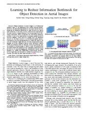
Object detection in aerial images is a fundamental research topic in the geoscience and remote sensing domain. ...
In this letter, we first underline the importance of the neck network in object detection from the perspective of information bottleneck. ...
Then, we propose a simple GSNet and FRM for enhancing feature representations for the neck network in object detection of aerial images. ...
arXiv:2204.02033v4
fatcat:e2fu6uixrjcr3pe5w6ok5xlrla
Multi-scale Aerial Target Detection Based on Densely Connected Inception ResNet
2020
IEEE Access
Preserved Fulltext
A copy of this work was available on the public web and has been preserved in the Wayback Machine. The capture dates from 2020; you can also visit the original URL.
The file type is application/pdf.
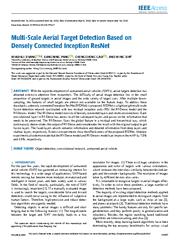
The difficulty of aerial image detection lies in the small proportion of ground targets in aerial images and the wide variety of target sizes. ...
Each convolutional layer in RI-Dense has access to all the subsequent layers and passes on the information that needs to be preserved. ...
To improve the detection results for aerial objects, an aerial target detection lightweight network is proposed, with fewer model parameters, a faster detection speed, and higher detection accuracy. ...
doi:10.1109/access.2020.2992647
fatcat:5ym2avtoxrhm3mjuezc2euc6le
Incident and Traffic-Bottleneck Detection Algorithm in High-Resolution Remote Sensing Imagery
2012
ITB Journal of Information and Communication Technology
Preserved Fulltext
A copy of this work was available on the public web and has been preserved in the Wayback Machine. The capture dates from 2016; you can also visit the original URL.
The file type is application/pdf.
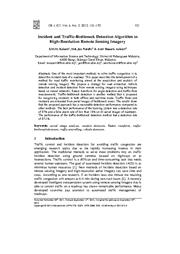
The best performance of the learning system was a detection rate of 87% and a false alarm rate of less than 18% on 45 aerial images of roadways. ...
Traffic-bottleneck detection is another method that is proposed for recognizing incidents in both offline and real-time mode. ...
No efficient previous study has been done on aerial images to find bottlenecks, while [34] used surveillance cameras for vehicle tracking to extract traffic information on freeways. ...
doi:10.5614/itbj.ict.2012.6.2.4
fatcat:qti5lfhlrjeephpw2r7kmbxrxa
Real-Time Vehicle Detection from Short-range Aerial Image with Compressed MobileNet
2019
2019 International Conference on Robotics and Automation (ICRA)
Preserved Fulltext
A copy of this work was available on the public web and has been preserved in the Wayback Machine. The capture dates from 2020; you can also visit the original URL.
The file type is application/pdf.
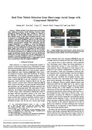
Vehicle detection from short-range aerial image faces challenges including vehicle blocking, irrelevant object interference, motion blurring, color variation etc., leading to the difficulty to achieve ...
In a nutshell, we reduce the bottleneck architecture number during the feature map downsampling stage but add more bottlenecks during the feature map plateau stage, neither extra FLOPs nor parameters are ...
For example, the black car largely occluded by light pole has been successfully detected (the right most figure in Fig. 4) . ...
doi:10.1109/icra.2019.8793673
dblp:conf/icra/HePLSC019
fatcat:6qz6aldgwraoncwjdyhwzh377m
Building Footprint Extraction from High-Resolution Images via Spatial Residual Inception Convolutional Neural Network
2019
Remote Sensing
Preserved Fulltext
A copy of this work was available on the public web and has been preserved in the Wayback Machine. The capture dates from 2019; you can also visit the original URL.
The file type is application/pdf.
The rapid development in deep learning and computer vision has introduced new opportunities and paradigms for building extraction from remote sensing images. ...
The proposed model shows promising potential for building detection from remote sensing images on a large scale. ...
for context mining, which enables learning rich semantics for detecting objects in complex backgrounds. ...
doi:10.3390/rs11070830
fatcat:7sw5tw72n5efdcv6ai65hi3k4u
Insulator Semantic Segmentation in Aerial Images Based on Multiscale Feature Fusion
2022
Complexity
Preserved Fulltext
A copy of this work was available on the public web and has been preserved in the Wayback Machine. The capture dates from 2022; you can also visit the original URL.
The file type is application/pdf.
Firstly, Initial Module and CA-Bottleneck which are used to extract features from images to generate finer feature maps are proposed in the Encoder path. ...
To solve these problems, this paper adopts an Encoder-Decoder architecture, called ED-Net, to realize end-to-end intelligent and accurate identification of insulators in aerial images. ...
[13] used the object detection network to identify insulators in aerial images and cropped the identified insulators from the images, which were input into the U-Net semantic segmentation network to ...
doi:10.1155/2022/2468431
fatcat:odp6ie7lgvcopmrxmr5aqiq7ni
Detection of Pine Wilt Nematode from Drone Images Using UAV
2022
Sensors
Preserved Fulltext
A copy of this work was available on the public web and has been preserved in the Wayback Machine. The capture dates from 2022; you can also visit the original URL.
The file type is application/pdf.
In this study, the YOLOv4 algorithm was used to automatically identify abnormally discolored wilt from pine wilt nematode disease on UAV remote sensing images. ...
To solve this problem, the lightweight deep learning network MobileNetv2 is used to optimize the backbone feature extraction network. ...
Franklin et al. proposed a new method for UAV tree species classification based on object image analysis and machine learning, using image segmentation technology to segment the acquired images. ...
doi:10.3390/s22134704
pmid:35808205
pmcid:PMC9269048
fatcat:kk5dhrgjizfp5khblslv3suap4
Extended Feature Pyramid Network with Adaptive Scale Training Strategy and Anchors for Object Detection in Aerial Images
2020
Remote Sensing
Preserved Fulltext
A copy of this work was available on the public web and has been preserved in the Wayback Machine. The capture dates from 2020; you can also visit the original URL.
The file type is application/pdf.
Although many advanced methods based on convolutional neural networks have succeeded in natural images, the progress in aerial images has been relatively slow mainly due to the considerably huge scale ...
In the EFPN, we first design the multi-branched dilated bottleneck (MBDB) module in the lateral connections to capture much more semantic information. ...
Acknowledgments: We are very grateful for the dataset provided by the relevant scholars. We also thank the peer reviewers for valuable suggestions and comments. ...
doi:10.3390/rs12050784
fatcat:z4bqyxppd5e25lyjy5yoby32vu
Robust Object Detection in Aerial Imagery Based on Multi-Scale Detector and Soft Densely Connected
2020
IEEE Access
Preserved Fulltext
A copy of this work was available on the public web and has been preserved in the Wayback Machine. The capture dates from 2021; you can also visit the original URL.
The file type is application/pdf.
Object detection in aerial images is vital for autonomous guidance, navigation and control, and situational awareness. ...
INDEX TERMS Object detection, aerial images, multi-scale detection, small object relative scale (ORS). ...
Though very efficient in detecting objects, deep learning methods are laborious when processing aerial images. ...
doi:10.1109/access.2020.2994379
fatcat:jcndzqo5yna3hiy6a2tmfz45hi
Object Detection in Thermal Images Using Deep Learning for Unmanned Aerial Vehicles
[article]
2024
arXiv
pre-print
Preserved Fulltext
A copy of this work was available on the public web and has been preserved in the Wayback Machine. The capture dates from 2024; you can also visit the original URL.
The file type is application/pdf.
Other Versions
2024
2024 IEEE/SICE International Symposium on System Integration (SII)
unpublished
doi:10.1109/sii58957.2024.10417611 fatcat:gqcnj6z56rflpp6w3vrmjd6q6u
doi:10.1109/sii58957.2024.10417611 fatcat:gqcnj6z56rflpp6w3vrmjd6q6u
This work presents a neural network model capable of recognizing small and tiny objects in thermal images collected by unmanned aerial vehicles. ...
The neck includes a BI-FPN block combined with the use of a sliding window and a transformer to increase the information fed into the prediction head. ...
Due to the low information content in thermal images, we perform calculations on surrounding pixels to detect the bounding box of the object.
A. ...
arXiv:2402.08251v1
fatcat:icrxu7jh5bg3nlgbp2wopkov54
Desertification Detection in Makkah Region based on Aerial Images Classification
2022
Computer systems science and engineering
Preserved Fulltext
A copy of this work was available on the public web and has been preserved in the Wayback Machine. The capture dates from 2022; you can also visit the original URL.
The file type is application/pdf.
Aerial images are classified using Convolutional Neural Networks (CNN) to detect land state variation in real-time. ...
In light of the current research, we assert the appropriateness of the proposed CNN model in detecting desertification from aerial images. ...
In this work, the transfer learning technique was applied on a CNN model to be used in aerial image classification for desertification detection. ...
doi:10.32604/csse.2022.018479
fatcat:rwpdzr43qbboxbsrxinknw5mfu
Lightweight Detection Network for Arbitrary-Oriented Vehicles in UAV Imagery via Global Attentive Relation and Multi-Path Fusion
2022
Drones
Preserved Fulltext
A copy of this work was available on the public web and has been preserved in the Wayback Machine. The capture dates from 2022; you can also visit the original URL.
The file type is application/pdf.
We then propose an angle classification prediction branch in the YOLO head network to detect arbitrarily oriented vehicles in UAV images and employ a circular smooth label (CSL) to reduce the classification ...
Recent advances in unmanned aerial vehicles (UAVs) have increased altitude capability in road-traffic monitoring. ...
[12] proposed an efficient channel attention pyramid YOLO (ECAP-YOLO) to detect small objects precisely in aerial images. Walambe et al. ...
doi:10.3390/drones6050108
doaj:84b2889f83644edfaf457793186a0f54
fatcat:5berbznplrhlnexn5uzqhay7iu
MultEYE: Monitoring System for Real-Time Vehicle Detection, Tracking and Speed Estimation from UAV Imagery on Edge-Computing Platforms
2021
Remote Sensing
Preserved Fulltext
A copy of this work was available on the public web and has been preserved in the Wayback Machine. The capture dates from 2021; you can also visit the original URL.
The file type is application/pdf.
We present MultEYE, a traffic monitoring system that can detect, track, and estimate the velocity of vehicles in a sequence of aerial images. ...
to an object detector backbone resulting in the MultEYE object detection architecture. ...
Here, deep learning methods are used for MOT for both object detection by using appearance information for re-identifying the detected object in the subsequent frames. ...
doi:10.3390/rs13040573
fatcat:savkzfch4bdf3mp3ae4eatjjyy
ℱ3-Net: Feature Fusion and Filtration Network for Object Detection in Optical Remote Sensing Images
2020
Remote Sensing
Preserved Fulltext
A copy of this work was available on the public web and has been preserved in the Wayback Machine. The capture dates from 2020; you can also visit the original URL.
The file type is application/pdf.
To this end, in this paper, we propose a feature fusion and filtration network (F3-Net) to improve object detection in RS images, which has higher capacity of combining the context information at multiple ...
Object detection in remote sensing (RS) images is a challenging task due to the difficulties of small size, varied appearance, and complex background. ...
Context Information in RS Object Detection The effectiveness of context information has been verified by many studies [43] [44] [45] in aerial object detection, especially for small objects or occluded ...
doi:10.3390/rs12244027
fatcat:jxhuwbvyx5fblkdkqpq55zjauu
A Lightweight Algorithm for Insulator Target Detection and Defect Identification
2023
Sensors
Preserved Fulltext
A copy of this work was available on the public web and has been preserved in the Wayback Machine. The capture dates from 2023; you can also visit the original URL.
The file type is application/pdf.
is significantly reduced to make it more suitable for edge-end deployment. ...
The accuracy of insulators and their defect identification by UAVs (unmanned aerial vehicles) in transmission-line inspection needs to be further improved, and the model size of the detection algorithm ...
Finally, actual aerial insulator images are used for training. ...
doi:10.3390/s23031216
pmid:36772255
pmcid:PMC9921440
fatcat:kirjlkfztbck3iae2deh7ami5e
« Previous
Showing results 1 — 15 out of 3,896 results