A copy of this work was available on the public web and has been preserved in the Wayback Machine. The capture dates from 2018; you can also visit the original URL.
The file type is application/pdf.
Filters
Image Mosaicking Approach for a Double-Camera System in the GaoFen2 Optical Remote Sensing Satellite Based on the Big Virtual Camera
2017
Sensors
This paper proposes a high accuracy image mosaicking approach based on the big virtual camera (BVC) in the double-camera system on the GaoFen2 optical remote sensing satellite (GF2). ...
The paper subtly uses the concept of the big virtual camera to obtain a stitched image and the corresponding high accuracy rational function model (RFM) for concurrent post processing. ...
Conclusions and Future Work In this paper, we have proposed an automatic image mosaicking approach for the double-camera system on the optical remote sensing satellite GF2, and subtly used the concept ...
doi:10.3390/s17061441
pmid:28632156
pmcid:PMC5492188
fatcat:rzmtf3kakjcv5kedbngxolhfca
Cloud-Assisted Remote Sensor Network Virtualization for Distributed Consensus Estimation
[article]
2015
arXiv
pre-print
We first propose a distributed sensor network virtualization algorithm that searches for, selects, and coordinates Internet-accessible sensors to perform a sensing task in a specific region. ...
We develop cloud-assisted remote sensing techniques for enabling distributed consensus estimation of unknown parameters in a given geographic area. ...
to perform cloud-assisted remote sensing based parameter estimation. ...
arXiv:1501.03547v1
fatcat:srplznimvbh5vehzfddmri7i74
MULTI-SENSOR SURVEYS FOR THE CHURCH OF SANT'AGNELLO ABATE. 3D MODELS AND VIRTUAL FRUITION
2022
The International Archives of the Photogrammetry, Remote Sensing and Spatial Information Sciences
Specifically, multi-sensor surveys have been performed and allowed the complete 3D documentation of the building. ...
Both for survey technologies and fruition modalities, low-cost systems were employed and tested. ...
In this last case, thanks to the use of increasingly accessible sensors, in addition to the implementation of image-matching algorithms and use in Structure from Motion software tools, multi-sensors result ...
doi:10.5194/isprs-archives-xlviii-2-w1-2022-199-2022
fatcat:tyktrxxnhnejpiv3s4gzmbpscm
Emulating and Evaluating Virtual Remote Laboratories for Cybersecurity
2020
Sensors
First, the fundamentals of a virtual remote laboratory hosted in the cloud are detailed. ...
In this sense, the calculated statistical values for the improved proposed model are within the expected ranges of reliability (X2 = 0.6, X2/DF = 0.3, GFI = 0.985, CIF = 0.985, RMSEA = 0) by considering ...
and its associated CyberScratch PID project for 2020; another project for the period 2017-2018 from the Computer Science Engineering Faculty (ETSI Informática) in UNED; and the Region of Madrid for the ...
doi:10.3390/s20113011
pmid:32466379
pmcid:PMC7309078
fatcat:b5puvfghhjeoxgb43ullcqyrzu
GPU-accelerated Multi-sensor 3D Mapping for Remote Control of Mobile Robots using Virtual Reality
2016
Proceedings of the 13th International Conference on Informatics in Control, Automation and Robotics
GPU-accelerated Multi-sensor 3D Mapping for Remote Control of Mobile Robots using Virtual Reality. ...
In this paper, a new virtual reality (VR) control concept for operating robots in search and rescue (SAR) scenarios is introduced. ...
Table 3 gives an overview of the average processing time of 10, 000 frames for the presented algorithm performed on the CPU and the GPU. ...
doi:10.5220/0005692200190029
dblp:conf/icinco/KleinschmidtW16
fatcat:uyzr6arstresfgjfp3xzzncapi
PERFORMANCE MEASUREMENT OF PHOTOELECTRIC DETECTION AND TARGET TRACKING ALGORITHM
2015
International Journal on Smart Sensing and Intelligent Systems
Through calculation and test , paperprovidesthe comparison results of the improved mean-shift and traditional mean-shift, verifies the correctness of the proposed algorithm and calculation models for photoelectric ...
To solve the unstable problem of target tracking detection system, this paper proposes an improved mean-shift algorithm for object tracking, establishes object tracking processing model;provides the processing ...
Wei Li, PERFORMANCE MEASUREMENT OF PHOTOELECTRIC DETECTION AND TARGET TARCKING ALGORITHM 1573 ...
doi:10.21307/ijssis-2017-819
fatcat:qrcgq46mhnhvtkpcdhcvej5jme
Wearable Sensors for COVID-19: A Call to Action to Harness Our Digital Infrastructure for Remote Patient Monitoring and Virtual Assessments
2020
Frontiers in Digital Health
As current viral tests and vaccines are slow to emerge, we see a need for more robust disease detection and monitoring of individual and population health, which could be aided by wearable sensors. ...
The COVID-19 pandemic has brought into sharp focus the need to harness and leverage our digital infrastructure for remote patient monitoring. ...
ACKNOWLEDGMENTS The authors acknowledge collaboration between Case Western Reserve University, University Hospitals Cleveland Medical Center, and the University of California Los Angeles as it relates ...
doi:10.3389/fdgth.2020.00008
pmid:34713021
pmcid:PMC8521919
fatcat:g22wxq2h25ed3hcsxcf63hgyre
A COMPARATIVE STUDY AMONG THREE REGISTRATION ALGORITHMS: PERFORMANCE, QUALITY ASSURANCE AND ACCURACY
2019
The International Archives of the Photogrammetry, Remote Sensing and Spatial Information Sciences
Even though this operation appears to be a solved and well-understood problem, the vast majority of available techniques still lack meaningful quality measures that allow the user to understand and analyze ...
Thus, this article compares three common registration algorithms, namely target-based registration, the Iterative-Closest Point algorithm (ICP) as well as a plane-based approach on examples related to ...
The International Archives of the Photogrammetry, Remote Sensing and Spatial Information Sciences, Volume XLII-2/W9, 2019 8th Intl. ...
doi:10.5194/isprs-archives-xlii-2-w9-779-2019
fatcat:tovr7rvcmrdmdhl3m7rbvdg5k4
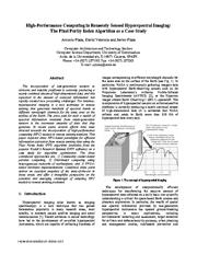
High-performance computing in remotely sensed hyperspectral imaging: the Pixel Purity Index algorithm as a case study
2006
Proceedings 20th IEEE International Parallel & Distributed Processing Symposium
In recent years, several efforts have been directed towards the incorporation of high-performance computing (HPC) models in remote sensing missions. ...
This paper explores three HPC-based paradigms for efficient information extraction from remote sensing data using the Pixel Purity Index (PPI) algorithm (available from the popular Kodak's Research Systems ...
in remote sensing missions. ...
doi:10.1109/ipdps.2006.1639607
dblp:conf/ipps/PlazaVP06
fatcat:zy4gbzznlvhbdohyjs5ok2uslu
Identifying Irrigated Areas in the Snake River Plain, Idaho: Evaluating Performance across Composting Algorithms, Spectral Indices, and Sensors
2017
Remote Sensing
Using six different pixel and county-scale error metrics, we evaluate the performance of these three algorithms across all possible combinations of two growing seasons (2002 and 2007), two datasets (MODIS ...
for the duration of the agricultural growing season. ...
Likewise, the Landsat remote sensing system has proven a useful tool for producing land-use maps [21, 22] . ...
doi:10.3390/rs9060546
fatcat:xwvljrd575cpfa75zeqrmoaee4
IMPROVING PERFORMANCE OF FEATURE EXTRACTION IN SFM ALGORITHMS FOR 3D SPARSE POINT CLOUD
2019
The International Archives of the Photogrammetry, Remote Sensing and Spatial Information Sciences
Moreover, this tool should be of great use for both art and architecture historians and geomatics experts, to study the evolution of Cultural Heritage. ...
However, the performance of these algorithms is limited by the fact that in some conditions the resulting point clouds present low density. ...
This is due to the intrinsic characteristics of the instruments, the sensor size and the distance between sensor and object (Bracci et al, 2018) . ...
doi:10.5194/isprs-archives-xlii-2-w17-101-2019
fatcat:cme5hfwk7bbavfcmdxspf4xxza
FEATURE-BASED QUALITY EVALUATION OF 3D POINT CLOUDS – STUDY OF THE PERFORMANCE OF 3D REGISTRATION ALGORITHMS
2013
The International Archives of the Photogrammetry, Remote Sensing and Spatial Information Sciences
In this term, a rigid registration process was performed. ...
Before starting the modeling process, we need to validate the quality of the registration results, and this is one of the most difficult and open research problems. ...
In section 4 we discuss the result of the FBQ evaluation used to compare the performances of registration algorithms. We then present our conclusions and perspectives for future works. ...
doi:10.5194/isprsarchives-xl-2-w2-59-2013
fatcat:vimkqxrw25hbtkl3nscicfyhaa
A First Assessment of the P-SBAS DInSAR Algorithm Performances Within a Cloud Computing Environment
2015
IEEE Journal of Selected Topics in Applied Earth Observations and Remote Sensing
We present in this work a first performance assessment of the Parallel Small BAseline Subset (P-SBAS) algorithm, for the generation of Differential Synthetic Aperture Radar (SAR) Interferometry (DInSAR ...
In particular, we investigate the scalable performances of the P-SBAS algorithm by processing a selected ENVISAT ASAR image time series, which we use as a benchmark, and by exploiting the Amazon Web Services ...
Parisi, and M.C. Rasulo for their technical support. ...
doi:10.1109/jstars.2015.2426054
fatcat:td4p3bubhja3ld3paxaakb3yj4
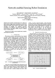
Network-enabled Sensing Robot Emulation
2007
2007 Fourth International Conference on Networked Sensing Systems
We will perform a demonstration of our research on sensor systems through the use of emulation on the particular case of network-enabled sensing robots. ...
The experiment will be performed remotely using Virtual Private Network (VPN) technology on StarBED, the large-scale experiment environment of the National ...
This makes it possible for researchers to test their algorithms and implementations in realistic conditions. ...
doi:10.1109/inss.2007.4297450
fatcat:mrtmgmej25fn3edc4hosuitrtu
A Review of Virtual Sensing Algorithms for Active Noise Control
2008
Algorithms
Additionally, the performance of these virtual sensing algorithms in numerical simulations and in experiments is discussed and compared. ...
Using the physical error signal, the control signal and knowledge of the system, these virtual sensing algorithms estimate the error signal at a location that is remote from the physical error sensor, ...
Summary of virtual sensing algorithms for active noise control. ...
doi:10.3390/a1020069
fatcat:tavfmu7k7nhcfee3f35ayiitzq
« Previous
Showing results 1 — 15 out of 48,616 results

