A copy of this work was available on the public web and has been preserved in the Wayback Machine. The capture dates from 2020; you can also visit the original URL.
The file type is application/pdf.
Filters
Multiscale Texture Analysis and Color Coherence Vector Based Feature Descriptor for Multispectral Image Retrieval
2019
Advances in Science, Technology and Engineering Systems
Content Based Image Retrieval (CBIR) for remote sensing image data is a tedious process due to high resolution and complexity of image interpretation. ...
Curvelet transform is used to decompose the image into coarse and detail coefficients. Then Gabor magnitude is computed for each coefficient to improve the directional information. ...
Chica-Olmo, et.al (2000) have proposed univariate and multivariate texture features by using spatial variability based variogram measures [11] . ...
doi:10.25046/aj040634
fatcat:elllei6nfvaurdxkvy2uiy36pe
Spatial Gap-Filling of ESA CCI Satellite-Derived Soil Moisture Based on Geostatistical Techniques and Multiple Regression
2020
Remote Sensing
Our results provide support for using geostatistical approaches (OK and RK) as alternative techniques to gap-fill missing spatial values of satellite-derived soil moisture. ...
Satellites offer critical information for soil moisture over large areas on a regular basis (e.g., European Space Agency Climate Change Initiative (ESA CCI), National Aeronautics and Space Administration ...
Acknowledgments: We thank Inder Tecuapetla for his input in the conceptual analysis of spatio-temporal correlation and Paula Olaya and Joe Teague for their comments to improve this work. ...
doi:10.3390/rs12040665
fatcat:xrc5jyh4eve6xa6wcikpu6dgvq
Review of Desert Mobility Assessment and Desertification Monitoring Based on Remote Sensing
2023
Remote Sensing
To combat desertification more accurately and effectively, the classification methods of moving dunes based on deep learning were also reviewed. ...
The research progress of desert vegetation coverage based on visual interpretation, the nonlinear spectral model, normalized vegetation index (NDVI) fitting and plant community classification was reviewed ...
For classification based on object extraction, many studies have used sliding windows to extract spectral features and texture features [89, 90] . Pi et al. ...
doi:10.3390/rs15184412
fatcat:2hazkkcdcjb7nhxt6kk2sfmxue
Basque Conference on Cyber Physical Systems and Artificial Intelligence
2022
Zenodo
Acknowledgements The authors would like to thank Aguas de Galicia from Xunta de Galicia for the support in the construction of the reference information for the multispectral images. ...
I am so grateful for that. ...
In other words, we use the local texture descriptor of the image as features for classification [6] . ...
doi:10.5281/zenodo.7039276
fatcat:dyorjakurnaxxgvgoojcbpyd5a
Basque Conference on Cyber Physical Systems and Artificial Intelligence
2022
Zenodo
Acknowledgements The authors would like to thank Aguas de Galicia from Xunta de Galicia for the support in the construction of the reference information for the multispectral images. ...
I am so grateful for that. ...
In other words, we use the local texture descriptor of the image as features for classification [6] . ...
doi:10.5281/zenodo.7010718
fatcat:a4gzrvtkybdbpmycqmjkvryco4
Knowledge Extracted from Copernicus Satellite Data
2019
Zenodo
By applying an already established active learning approach based on a Support Vector Machine with relevance feedback [2], we can limit ourselves to a limited number of typical satellite images to extract ...
For doing this, we propose to select overlapping target areas from Synthetic Aperture Radar and multispectral images acquired with rapid succession. ...
The system integrate data, product, information for user to access. Data management system focus data integration and applications. ...
doi:10.5281/zenodo.3941573
fatcat:zzifwgljifck5bpjnboetsftfu
Back Matter
[chapter]
Color Image Processing with Biomedical Applications
Image segmen-
tation of cell nuclei based on classification in the color space. ...
Automated renal
cell carcinoma subtype classification using morphological, texture and
wavelets based features. Journal of Signal Processing Systems, 55:15-
23, 2009. ...
doi:10.1117/3.887920.bm
fatcat:dmyx3hkw4nbbrncvygr6hqj6jq
Ground, Proximal and Satellite Remote Sensing of Soil Moisture
2019
Reviews of Geophysics
for novel applications of SM information for water resources management, sustainable environmental development, and food security. ...
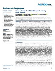
Soil moisture (SM) is a key hydrologic state variable that is of significant importance for numerous Earth and environmental science applications that directly impact the global environment and human society ...
The values of these two parameters are available for the 12 soil textural classes of the USDA classification scheme (Carsel & Parrish, 1988; Sadeghi, Tabatabaeenejad, et al., 2017) . ...
doi:10.1029/2018rg000618
fatcat:hcfa2uqiz5ffnf7o3fijc6rnwu
Toward a new generation of satellite surface products?
2006
Journal of Geophysical Research
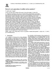
The need for careful satellite calibration is stressed, and the scaling problem is emphasized. ...
Innovative techniques have to be developed to merge these information sources and optimize the use of satellite measurements for better surface products and more predictability. ...
Technical Implications for the Multivariate Case [40] In this section, we comment on some technical implications arising when multivariate strategies are used. ...
doi:10.1029/2006jd007362
fatcat:dyyqmfvjlfdifjfe723hyml5ca
Feature visualization in large scale imaging mass spectrometry data
[article]
2009
This work was carried out in the context of the Virtual Laboratory for e-Science project (http://www.vl-e.nl). ...
The research reported in this thesis was carried out at CWI, the Dutch national research institute for Mathematics and Computer Science, within the theme Visualization and 3D User Interfaces, a subdivision ...
Some-combinations of-other image characteristics acting as a weight like a gradient-based metric or maybe a variogram-based approach may create some improvement in certain cases. ...
doi:10.6100/ir641962
fatcat:2r5nwkwksjdvlhonafnn6vdgwe
Xxxii Scar Open Science Conference 'Antarctic Science And Policy Advice In A Changing World - Conference Abstracts
[article]
2016
Zenodo
These new magnetic data together with survey data that were not previously in the public domain can significantly upgrade the ADMAP compilation for crustal studies of the Antarctic. ...
Data analyses included rarefaction, hierarchical classification, multivariate analyses, assessment of richness trends by latitude bands, and use of the Jaccard similarity index. ...
Sencondly, it's the image clipping and image registration for the ASAR images of the same scene acquired at different times. ...
doi:10.5281/zenodo.53122
fatcat:o56w4vr3n5bsvkyj6vnetfem3e
Establishing common standards and requirements for Earth Observation management, access and sharing:
2011
It also referred to the management of spatial patterns and management issues through Open Source Software, while addressing the effectiveness and usability for the Balkans. ...
within the international project OBSERVE, which aims to help coordinate and intensify cooperation between the Balkan countries in the field of Earth Observation, which is a goal of paramount importance for ...
, calculate (pseudo) cross variograms, calculate and fit directional variograms and variogram models (anisotropy coefficients are not fitted automatically), and more. EOMF (Earth Observation and Modeling ...
doi:10.26262/heal.auth.ir.128230
fatcat:dd4msztzdfaevh6vu3to5wevoe
75. Jahrestagung der Deutschen Geophysikalischen Gesellschaft : 23.–26. März 2015 in Hannover
2017
We thank the companies EMPG (Hannover), GDF SUEZ (Lingen), RWE Dea AG (Hamburg), and Wintershall Holding GmbH (Kassel) for financing the project and the authorization to present the results. ...
Anisotropic variograms are integrated the vertical variograms along boreholes data and an omni-directional variogram from Buntsandstein (sandstone) at larger scale. ...
For example, partitioning or model-based cluster analyses, e.g., fuzzy c-means or EM, analyze just the color or absolute values and they do not consider other features like edges and texture in the maps ...
doi:10.2312/dgg75
fatcat:shzdrjap3nh35oqyj77hemoniy

