A copy of this work was available on the public web and has been preserved in the Wayback Machine. The capture dates from 2017; you can also visit the original URL.
The file type is application/pdf.
Filters
Cross-Polarized Synthetic Aperture Radar: A New Potential Measurement Technique for Hurricanes
2012
Bulletin of The American Meteorological Society - (BAMS)
Co-Polarization Model: CMOD5.N
1:wind speed, wind direction and radar
incidence angle dependence.
2: Aircraft measurements
Fernandez et al. 2006
He, Y., and Perrie, W. 2008: Speed ambiguity ...
in hurricane wind retrieval from SAR imagery. ...
doi:10.1175/bams-d-11-00001.1
fatcat:sp7vrqdb5bfe3npwajnn5fil64
Ocean Surface Wind Speed of Hurricane Helene Observed by SAR
2011
Procedia Environmental Sciences
The hurricanes can be detected by many remote sensors, but synthetic aperture radar (SAR) can yield high-resolution (sub-kilometer) and low-level wind information that cannot be seen below the cloud by ...
With wind direction from the outputs of U.S. ...
In contrast to the scatterometer, satellite-borne synthetic aperture radar (SAR) instruments can provide wind fields on a much finer scale because of their high spatial resolution (sub-kilometer). ...
doi:10.1016/j.proenv.2011.09.327
fatcat:w66hpib4gzb47hkc7voxlmhnla
Spaceborne sar imaging of coastal ocean phenomena
2010
2010 IEEE International Geoscience and Remote Sensing Symposium
Wide-swath synthetic aperture radar (SAR) observes the large-scale ocean surface wind field. ...
boundary phenomena, i.e., atmospheric gravity waves [Li et al., 2004], vortex streets [Li et al., 2008b], and hurricanes are often observed in SAR images. ...
The derived sea surface hurricane winds (Figure 3 ) are compared with coincident airborne Stepped Frequency Microwave Radiometer (SFMR) measurements. ...
doi:10.1109/igarss.2010.5653363
dblp:conf/igarss/LiPY10
fatcat:hghvxfnarnerrhencfbpmwpk7y
Brief communication: Hurricane Dorian: automated near-real-time mapping of the "unprecedented" flooding in the Bahamas using synthetic aperture radar
2020
Natural Hazards and Earth System Sciences
In this communication, we present application of the automated near-real-time (NRT) system called RAdar-Produced Inundation Diary (RAPID) to European Space Agency Sentinel-1 synthetic aperture radar (SAR ...
) images to produce flooding maps for Hurricane Dorian in the northern Bahamas. ...
The authors would like to thank the European Space Agency for granting free access to Sentinel-1 synthetic aperture radar data at 10 m grid spacing. Review statement. ...
doi:10.5194/nhess-20-1463-2020
fatcat:3k36qibgqvhq7eqsuztgpa6exm
Tracking Analysis of Hurricane Gonzalo Using Airborne Microwave Radiometer
2016
International Journal of Microwave Engineering
By flying special aircraft equipment using synthetic thinned array radiometry technology and included all critical measurements such as hurricane eye location, speed of wind and the pressure. ...
The airborne hurricane tracking is an important method compared with the space borne method, which is developed by NASA Marshall Space Flight center to provide high resolution measurements. ...
ACKNOWLEDGEMENTS The authors wish to acknowledge the collaboration with Dr. B.Sayak at NASA / MSFC Marchall Space Flight Center, USA who provided the data. ...
doi:10.5121/jmicro.2016.1203
fatcat:mjaibux76fan7e6syk4vq7h5ai
Developing a Quality Index Associated with Rain for Hurricane Winds from SAR
2018
Remote Sensing
Differences in synthetic aperture radar (SAR)-retrieved hurricane wind speeds from co-polarization and cross-polarization measurements are found to be correlated with rain rate. ...
The quality flags provide confidence levels of hurricane surface winds from SAR, which together with the proposed method to correct wind retrievals in rain-contaminated areas, can contribute to improved ...
We thank the Canadian Space Agency for the RADARSAT-2 SAR images through the Hurricane Watch program, the Hurricane Research Division of NOAA for providing aircraft-based data measurements, and Risk Management ...
doi:10.3390/rs10111783
fatcat:vechk325uzabvlf2qwdj3elkfe
Tropical cyclone vector winds from C-band dual-polarization synthetic aperture radar
2013
2013 IEEE International Geoscience and Remote Sensing Symposium - IGARSS
function allows optimum estimates for the wind speeds and directions. ...
The wind direction ambiguities are removed by a parametric two dimensional sea-surface inflow angle model. ...
ACKNOWLEDGEMENTS The authors thank the Canadian Space Agency (CSA) for providing RADARSAT-2 dual-polarization SAR hurricane imagery, and NOAA HRD and NDBC for supplying SFMR and buoy observations, respectively ...
doi:10.1109/igarss.2013.6723589
dblp:conf/igarss/ZhangPHQG13
fatcat:tjhbf7r7fjhrnmbglcz6hn2jzm
Tropical Cyclone Morphology from Spaceborne Synthetic Aperture Radar
2013
Bulletin of The American Meteorological Society - (BAMS)
1 In 2008, the Canadian Space Agency sponsored the RADARSAT Hurricane Applications Project 2 (RHAP), for researching new developments in the application of RADARSAT-1 synthetic 3 aperture radar (SAR) data ...
In addition to the wind 7 field and tropical cyclone eye information, structures associated with atmospheric processes can 8 also be detected by SAR. ...
Capsule 1 We analyze the sea surface imprints of 83 hurricanes imaged by spaceborne synthetic aperture 2 radar. ...
doi:10.1175/bams-d-11-00211.1
fatcat:m5wskfgi4navxgugulg4hqqml4
Extreme wind conditions in tropical cyclones observed from synthetic aperture radar images
2007
2007 IEEE International Geoscience and Remote Sensing Symposium
Tropical cyclone is a generic term which comprises hurricanes in the Atlantic Ocean and Northeast Pacific Ocean, typhoons in the Northwest Pacific Ocean, and cyclones in the Indian Ocean and Southwest ...
using SAR (Synthetic Aperture Radar) data. ...
Synthetic aperture radar can be used to measure high resolution wind field and ocean wave parameters. ...
doi:10.1109/igarss.2007.4422941
dblp:conf/igarss/ReppucciLSB07
fatcat:ezxpi3xgwzg2tfyfb3bsrsakku
Page 637 of American Society of Civil Engineers. Collected Journals Vol. 114, Issue 11
[page]
1988
American Society of Civil Engineers. Collected Journals
More promising are remote sensing techniques such as synthetic aperture radar (SAR) and radar altimeters (ALT), which have provided data from a limited number of hurricanes (King and Shemdin 1978; Gonzalez ...
The physics of the generation process within hurricanes is complicated by the rapidly turning winds which generate cross-seas. ...
Co‐ and Cross‐ polarized SAR measurements for high resolution description of major hurricane wind structures : Application to Irma category‐5 Hurricane
2019
Journal of Geophysical Research - Oceans
C-band high-resolution radar (synthetic aperture radar [SAR]) is the only spaceborne instrument able to probe at very high resolution and over all ocean basins the sea surface under extreme weather conditions ...
When coanalyzed with Stepped Frequency Microwave Radiometer wind estimates, the radar backscatter signals acquired in major hurricanes from Sentinel-1 and Radarsat-2 SAR reveal high sensitivity in the ...
SAR = synthetic aperture radar.
Figure 6 . 6 Irma ocean surface wind profiles with SAR observation and multiple satellite platform analysis. ...
doi:10.1029/2019jc015056
fatcat:fjkgjrvtrrgf7bulzflegp65ly
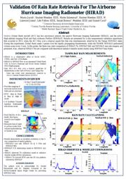
Validation of rain rate retrievals for the airborne Hurricane Imaging Radiometer (HIRAD)
2015
2015 IEEE International Geoscience and Remote Sensing Symposium (IGARSS)
NASA's Global Hawk aircraft (AV1) has two microwave sensors: the passive Hurricane Imaging Radiometer (HIRAD), and the active High-altitude Imaging Wind and Rain Airborne Profiler (HIWRAP). ...
Results are presented for a rain measurement validation opportunity that occurred in 2013, when the AV 1 flew over a tropical squall-line that was simultaneously observed by the Tampa NEXRAD radar. ...
surface wind
field and rain structure
• IFOV~2km @ Nadir
& 5km @ edge of
swath
• 1-D Synthetic Thinned
Aperture Radiometer
with 40 km swath
• 4-freq C-band Radiometer
• 4, 5, 6 & 6.6 GHz ...
doi:10.1109/igarss.2015.7325911
dblp:conf/igarss/JacobSJBC15
fatcat:d3io2ffrezedpcda5xi7bxk6pe
On Extreme Winds at L-Band with the SMAP Synthetic Aperture Radar
2019
Remote Sensing
In this letter, we discuss some observations of the Soil Moisture Active Passive (SMAP) mission's high-resolution synthetic aperture radar (SAR) for extreme winds and tropical cyclones. ...
We show that the SMAP SAR instrument is capable of measuring extreme winds up to the category 5 (70 m/s) wind speed regime providing unique capabilities as compared to traditional scatterometers with C ...
SMAP has three types of radar observations: a full-aperture measurement with approximately 36 km resolution, a range-sliced measurement with 5 × 36 km resolution, and a synthetic aperture radar (SAR) mode ...
doi:10.3390/rs11091093
fatcat:ccj7e22itnahno55jg6zshe2s4
Tropical Cyclone Boundary Layer Rolls in Synthetic Aperture Radar Imagery
2018
Journal of Geophysical Research - Oceans
Recently, a relatively new satellite remote sensing tool, synthetic aperture radar (SAR), has also been utilized to study the MABL rolls. ...
Spaceborne synthetic aperture radar (SAR) provides a unique capability to image the sea surface imprints of quasi-linear streaks induced by the MABL rolls within a TC. ...
Two C-band SAR images over Hurricane Katrina 2005, are acquired by Advanced Synthetic Aperture Radar (ASAR) ScanSAR wide mode and RADARSAT-1 ScanSAR wide mode, respectively. ...
doi:10.1029/2018jc013755
fatcat:aqeyatuw4jakvmcb66wogstdxm
Sea Surface Roughness Observed by High Resolution Radar
2019
Remote Sensing
Changes in the sea surface roughness are usually associated with a change in the sea surface wind field [...] ...
A number of features on the sea surface associated with changes in roughness can be observed by synthetic aperture radar (SAR) because of the change in Bragg backscatter of the radar signal by damping ...
Changes in the sea surface roughness are usually associated with a change in the sea surface wind field. This interaction has been exploited to measure the sea surface wind speed by scatterometry. ...
doi:10.3390/rs11172026
fatcat:7irl5sxqa5euln2rqxyfacvl4m
« Previous
Showing results 1 — 15 out of 892 results

